
E5 Alpine Crossing 2026: Stages, packing list & map for beginners
The E5 Alpine crossing from Oberstdorf after Merano The E5 is one of Europe's most famous long-distance hiking trails – and rightly so. In July 2024, I set off with my DJI Mini 4 Pro in my backpack to not only hike the classic E5 route, but also to capture it with drone footage from perspectives that hikers would never see. In this report, I share everything you need to know for your own E5 hike: the individual E5 stages in detail, an honest assessment of the difficulty, my complete packing list, all costs, and the best drone spots along the route.
- Oberstdorf (Allgäu) to Merano (South Tyrol) via Kemptner Hütte, Memminger Hütte and Braunschweiger Hütte at 2,759 meters.
- Approximately 71 km of pure hiking distance in 5-6 stages with 4,650 meters of ascent and 5,150 meters of descent.
- Best time to travel: End of June to mid-September — only then are all DAV huts open and the high alpine passes free of snow.
- Between 450 and 650 euros per person including overnight stay in a mountain hut with half board, cable car rides and bus transfers.
- Difficulty: T2 to T3, sure-footedness required. Anyone who can manage 10 km with 500 meters of elevation gain in everyday life can handle the route.
Here are the key facts: The E5 trail leads from Oberstdorf in the Allgäu region of Germany, through the Austrian Lechtal valley and the Ötztal Alps, to Merano in South Tyrol in five to six days. You'll cover around 20,000 meters of elevation gain and loss, cross three countries, and experience four completely different landscapes within a single week – from the lush Allgäu countryside to rugged high mountain scenery and Mediterranean vineyards. Over 13,000 people hike this route every year, and from my own experience, I understand why.
E5 Alpine Crossing Stages: The route on the map
Before I delve into the details of each individual stage, here's an overview of the classic route.
| stage | From → To | distance | Ascent | Walking time | difficulty |
|---|---|---|---|---|---|
| 1 | Oberstdorf → Kemptner Haus | ~16 km | 1,050 m | 5-6h | Medium |
| 2 | Kemptner House → Memminger Hut | ~15 km | 1,200 m | 7-8h | Difficult |
| 3 | Memminger Hut → Braunschweig Hut | ~12 km | 1,400 m | 6-7h | Difficult |
| 4 | Braunschweiger Hütte → Sölden | ~10 km | 200 hm | 4-5h | Medium |
| 5 | Sölden → Timmelsjoch → Merano | ~18 km | 800 hm | 6-7h | Medium |
Total distance: ~71 km | Total ascent: ~4,650 m | Total descent: ~5,150 m | Duration: 5-6 days
Stage 1: Oberstdorf to the Kemptner Haus (1,846m) – The green start
The first stage of the E5 Alpine crossing starts at Oberstdorf train station (813m) and leads south through the Trettach Valley. The landscape is typical of the Allgäu region: lush alpine meadows, mountain farms, and the sound of cowbells in the background. It almost feels too tame for the start of a long-distance alpine hike.
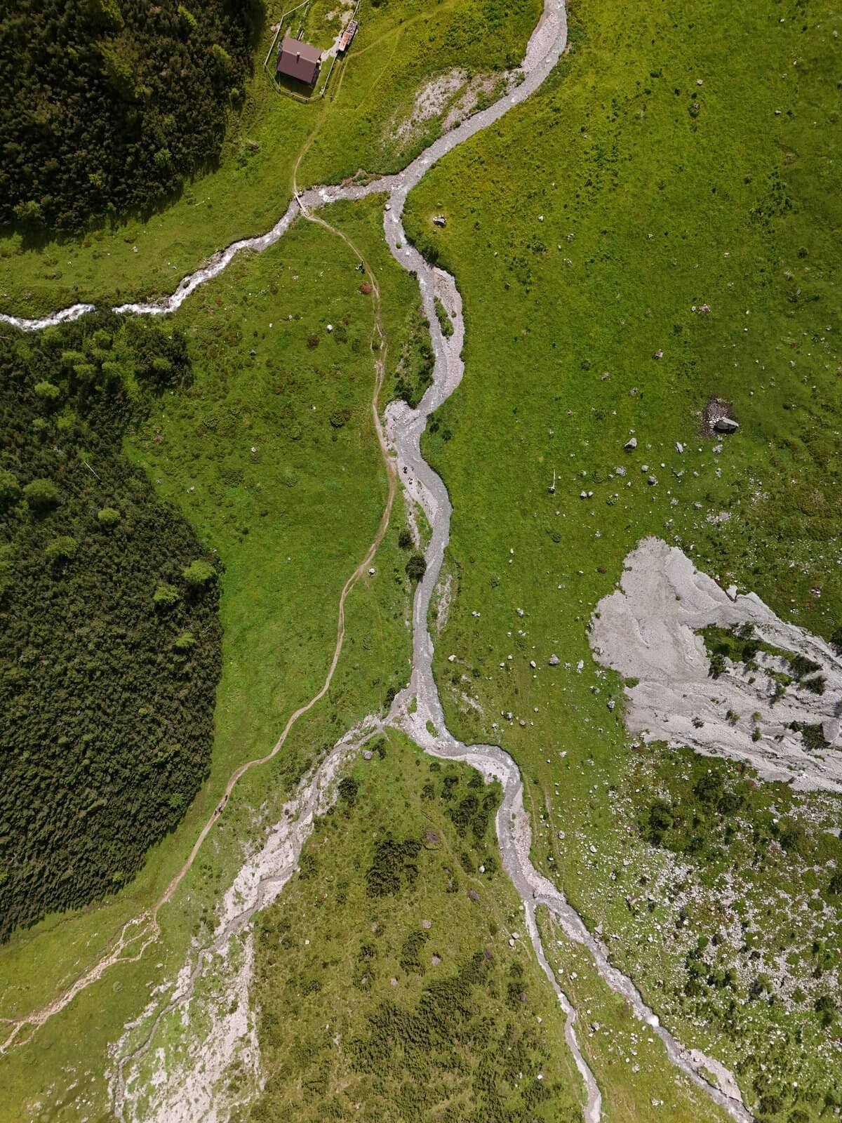
At 1,000m, things change. The path becomes steeper, the forest denser, and the last signs of civilization disappear. The material cable car for the Kemptner Hütte marks the point where things get really strenuous. The ascent through the rocky gorge with its roaring waterfalls is exhausting, but the drone footage I took here is among my favorites of the entire tour – the turquoise water cascading through moss-covered rocks is a completely different world from above.
The Kemptner Haus is one of the largest German Alpine Club (DAV) huts with 300 beds. The atmosphere in the evenings is fantastic – you sit with like-minded people from all over Europe, exchange route tips, and enjoy a well-deserved beer after a long day. Important: During peak season (July/August), be sure to book in advance, as the hut is often full weeks ahead.
Stage 2: Over the Mädelejoch to the Memminger Hütte (2,242m) – The toughest stage
Day two is the big one. You cross the border into Austria via the Mädelejoch (1,974m), descend steeply into the Lechtal valley, and then face the toughest climb of the entire E5 hike: 1,100 meters of elevation gain without any significant flat sections up to the Memminger Hütte.
It's wild and impressive. Rushing mountain streams, snowfields in July, and rock faces that rise several hundred meters vertically. Only from the drone do you realize how tiny the hikers appear on the narrow path – a change in perspective that makes the scale of this landscape comprehensible.
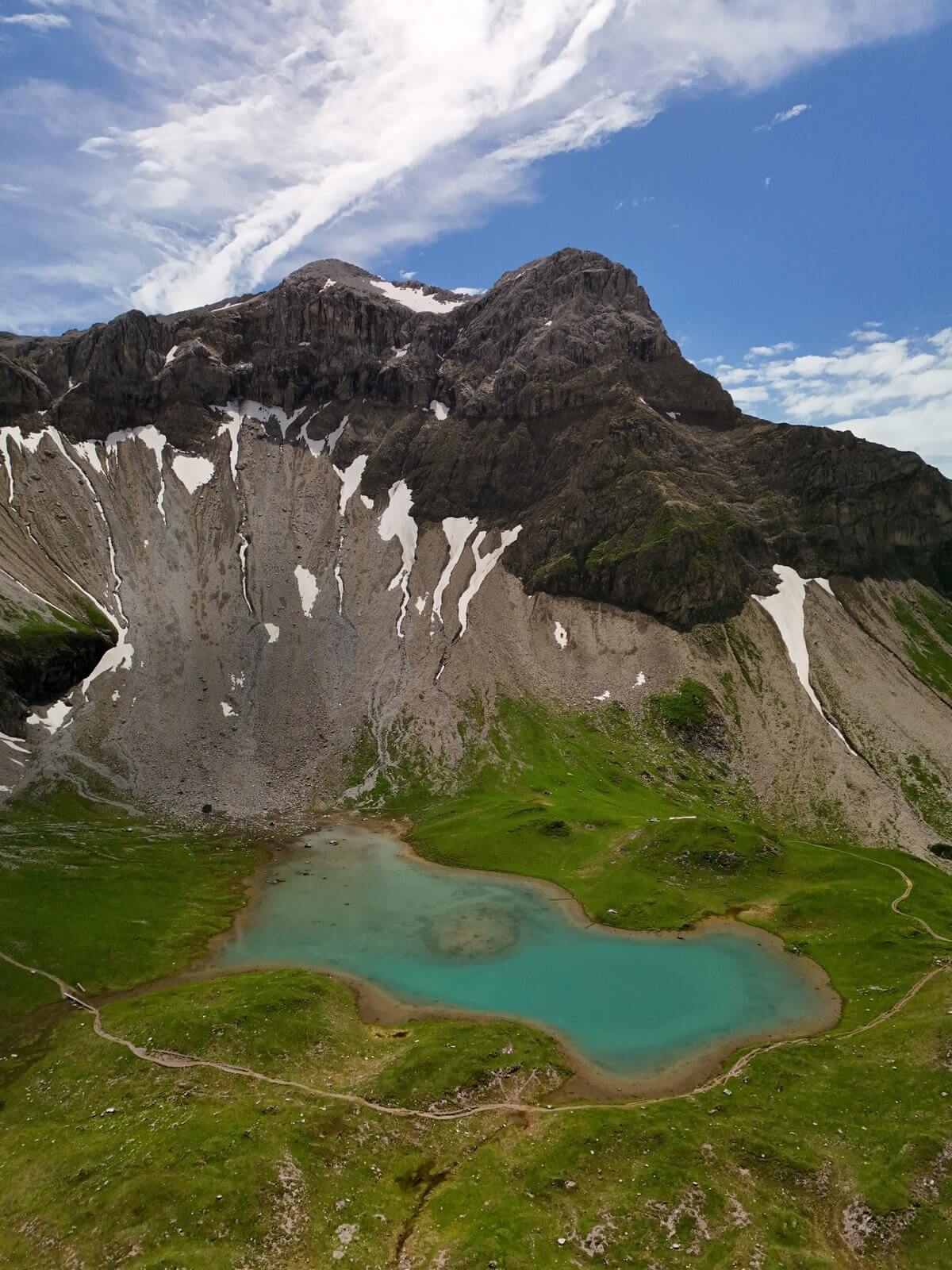
The reward awaits at the top: The Memminger Hütte mountain hut sits directly above the Seewisee, one of the most photogenic mountain lakes in the Alps. At sunrise, the surrounding peaks are perfectly reflected in the still, turquoise water. For drone photography, this spot is the absolute highlight of the E5 trail – I've taken some of the best aerial photos of my entire travels here at sunrise.
Tip for this stage: Start as early as possible (before 7 a.m.) to avoid the midday heat on the climb to Memminger. Take at least 2 liters of water with you – there are no opportunities to refill along the way.
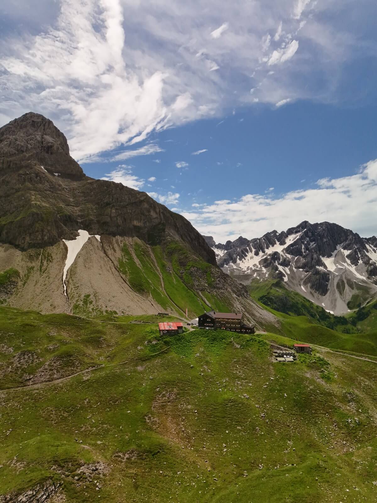
Stage 3: To the Braunschweiger Hütte (2,759m) – The roof of the Alpine crossing
Stage 3 takes you to another world. After descending from the Memminger Hütte, a short bus transfer through the Pitztal valley follows, before the ascent to the Braunschweiger Hütte begins – the highest point of the classic E5 route at 2,759 meters.
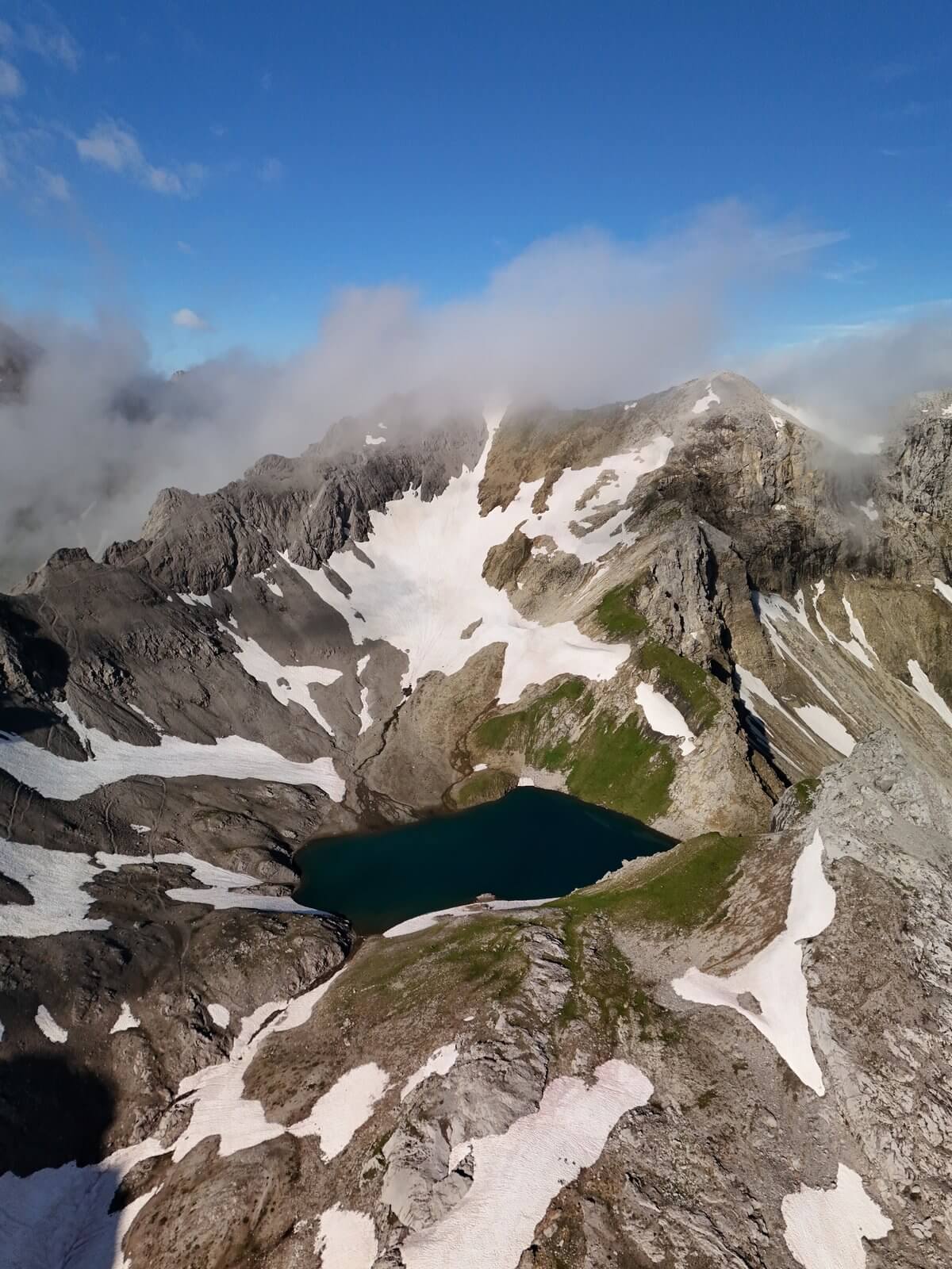
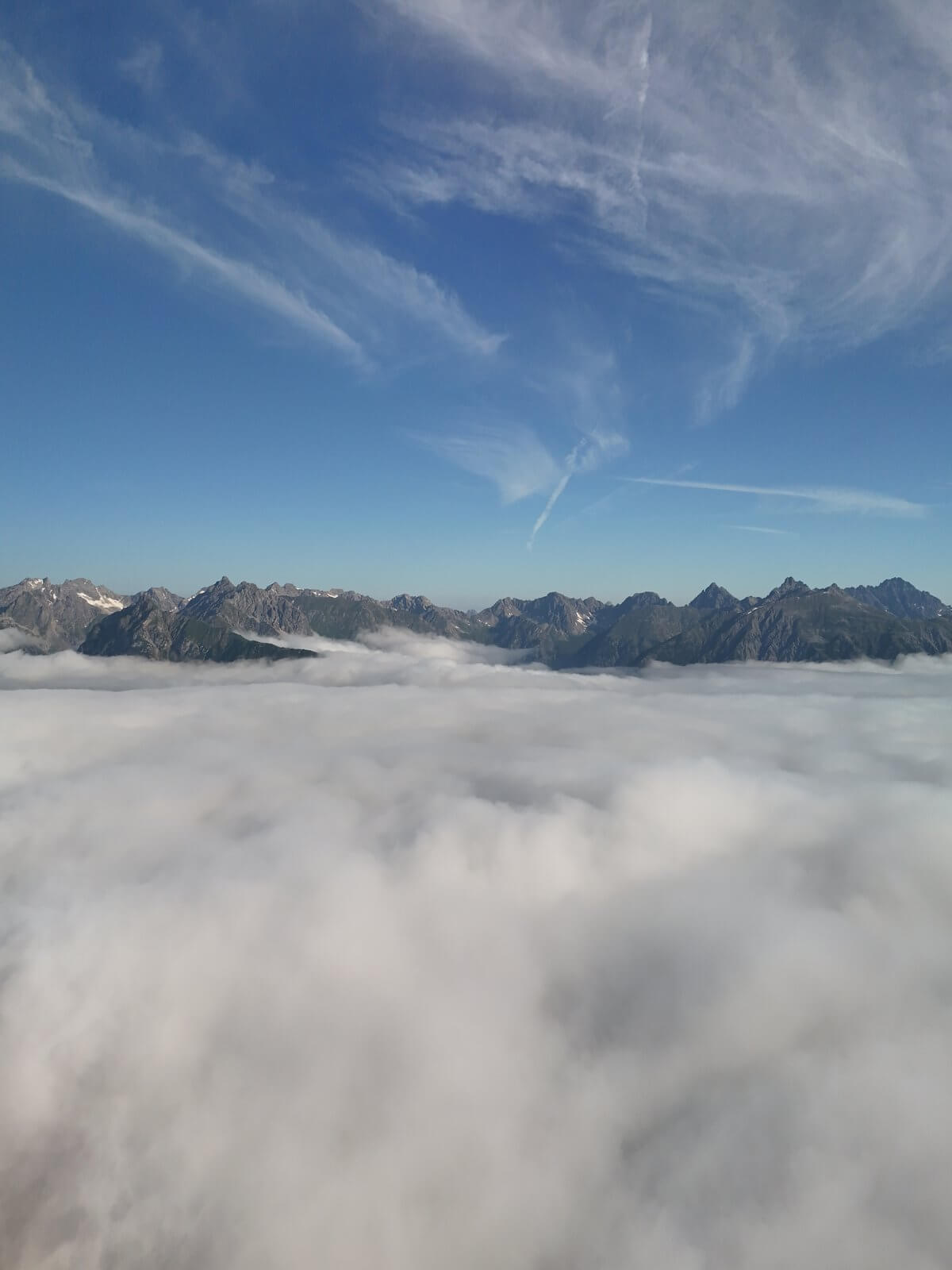
The landscape changes dramatically: Green alpine meadows give way to barren scree, the last trees disappear, and snowfields and remnants of glaciers dominate the scene. The air thins and the temperature drops noticeably. Up here, you're in a world of rock, ice, and endless sky. The 360-degree drone panoramas of the Ötztal Alps, with the Mittelbergferner Glacier right next to the hut, are breathtaking.
The Braunschweiger Hütte clings to the rock face next to the glacier. At night, you can hear the ice creaking – a reminder of how vibrant and yet fragile this high-alpine world is. Important: Above 2,500 meters, frost is possible even in midsummer. Warm clothing (down jacket, hat) is essential for the evening, even if you've been hiking in a T-shirt during the day.
Stages 4 & 5: Via Sölden and the Timmelsjoch Pass to Merano – From the ice to the south
The last two days of the Alpine crossing offer the ultimate contrast. From the Braunschweiger Hütte, the trail leads down through the Rettenbach valley to Sölden – the only night in a proper bed on the tour and a welcome opportunity for a hot shower and dinner without the half-board of a mountain hut.
On the last day, the transfer takes you to the Timmelsjoch Pass (2,474m), the highest paved mountain pass in the Eastern Alps and the border between Austria and South Tyrol. The descent to Merano is like a journey through time: within just a few hours, you go from snowfields to larch forests, then to vineyards and apple orchards. In Merano (325m), you suddenly find yourself sitting among palm trees, drinking espresso, hardly able to believe that just five days ago you were standing in the snow-covered high mountains.
The reservoir near Vernagt shimmers in an unreal turquoise hue nestled between steep mountain slopes – perfect for the final drone shot of the tour. The Merano thermal baths are the ideal finale: soothing tired muscles in 34°C warm water, with a view of the very mountains you just crossed.
E5 Costs – What crossing the Alps really costs (as of 2024)
Here is an honest breakdown of all costs for the E5 hike, based on my tour in July 2024:
| Position | DAV members | Non-members |
|---|---|---|
| 4 nights in mountain huts (half board) | 180-220 € | 250-300 € |
| 1 Hotel Sölden | 80-120 € | 80-120 € |
| Transfers (Pitztal, Timmelsjoch) | 30-50 € | 30-50 € |
| Food on the go | 40-60 € | 40-60 € |
| Total (excluding travel) | ~450-550 € | ~550-650 € |
E5 Packing List – What really needs to be in your backpack
After six days on the E5, I know exactly what was worth its weight in gold and what was just unnecessary weight. My backpack weighed 9.5 kg at the start – and that was just right. Here's my tried-and-tested tip.
Absolute must-haves:
- Hiking boots with high shafts, stiff soles, well broken in – the E5 has scree, snowfields and steep descents.
- Rain jacket (Gore-Tex or equivalent) – Alpine weather can change completely in 30 minutes
- Sleeping bag liner – mandatory in all DAV/ÖAV huts, silk models weigh only 150g
- Sunscreen SPF 50+ – UV radiation at 2,700m is brutal, sunburn on day 2 ruins the tour.
- Telescopic trekking poles – indispensable for the knees when dealing with a total load of 20,000 meters in altitude.
- DJI Mini 4 Pro drone – under 249g, no registration required in Austria and Italy, fits in any backpack side pocket
Surprisingly useful:
- Gaiters – indispensable for snowfields in July (I had never used them before)
- Buff/Multifunctional scarf – sun protection, wind protection, headband, towel substitute, all in one
- 20,000mAh power bank – powers drone, mobile phone and GPS watch throughout the entire tour
- Earplugs – dormitories in cabins with 30 people can be surprisingly loud.
More than 3 T-shirts (wash in the evening, dry overnight), heavy DSLR camera (the drone completely replaces it for landscape shots), provisions for all days (each cabin has food and a small shop).
Crossing the Alps for beginners: How difficult is the E5 really?
An honest assessment of the difficulty of the E5 Alpine crossing: moderate to difficult. The individual stages, with 5-8 hours of walking time and up to 1,400 meters of elevation gain, are challenging but technically manageable. There are no via ferratas, no glacier crossings, and no sections requiring a rope. Some sections (Mädelejoch, ascent of the Braunschweiger Pass) have wire rope protection.
The real challenge lies in the accumulation: five tough days in a row, with a backpack, in changing weather. On the third day, you feel it in your legs from the day before, on the fourth you wonder why you're putting yourself through this – and on the fifth, during the descent to Merano, you remember.
Three months beforehand, regularly undertake day hikes with a backpack (8-10 kg), including at least one hike per week with 1,000+ meters of elevation gain. Additionally, jog or cycle twice a week to build basic endurance. Anyone who takes this preparation seriously will be fit enough for the E5.
Can a beginner do the E5? Yes, but only with proper preparation. Mountain hiking is not a walk in the park, and sure-footedness (the ability to walk confidently on uneven terrain) and a head for heights in some sections are absolutely essential. If you're unsure, a guided tour (from around €800 per person) is a good idea – a mountain guide can adapt the stages to the group's pace.
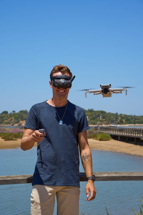
Drone photography on the E5 – spots, rules & tips
As a content creator, the drone was my most important tool on this trip. The DJI Mini 4 Pro weighs 249g, placing it in the lightest category in Austria and Italy – no registration required, no drone license needed. You hardly notice it in your backpack.
The best drone spots on the E5:
- Waterfalls near Spielmannsau (Stage 1) – turquoise water in a moss-covered gorge, top-down perspective
- Suspension bridge in the Trettach Valley (Stage 1) – geometric motif, bridge over a wild gorge
- Seewisee near the Memminger Hütte (Stage 2) – THE spot for sunrise, reflections in the lake
- Braunschweiger Hütte & Glacier (Stage 3) – 360° panorama of the Ötztal Alps
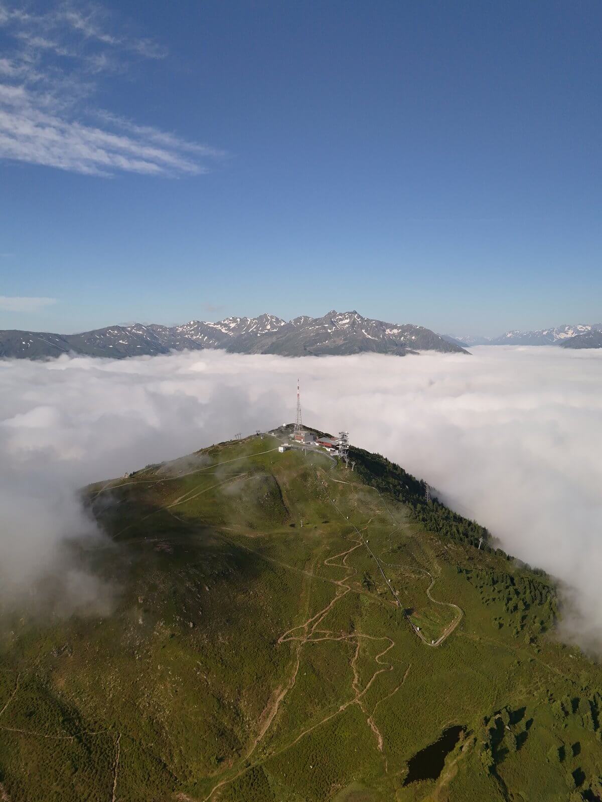
- Sea of clouds (stage 3/4, weather dependent) – when the clouds are below you, there is no better drone subject
- Vernagt Reservoir (Stage 5) – turquoise lake nestled between steep mountain slopes, a perfect finale
Flying drones is prohibited in nature reserves (such as the Hohe Tauern National Park). There are no national parks along the E5 trail, but there are several protected areas. A general rule of thumb: never fly over groups of people, keep your distance from other hikers, and fly early in the morning or in the evening when it's less crowded. Ask permission before flying near mountain huts – most hut owners don't mind as long as you are respectful.
E5 long-distance hiking trail: Best time to travel, booking & getting there (insider tips)
Mid-June to mid-September. July and August are the peak season – offering the most stable weather conditions, but also the busiest mountain huts. September offers fewer hikers and often still good weather, although many huts close in mid-September. I hiked in early July and had good weather on four out of six days – a realistic figure for the Alps.
Hut booking: Booking opens for most huts on March 1st and is mandatory. Without a reservation, a bed is not guaranteed. The Memminger Hut and the Kemptner House are usually the first to fill up – book these two first. Bookings can be made through the websites of the respective Alpine Club sections or via the central DAV hut booking system.
Oberstdorf is easily accessible by train – about 2 hours from Munich and about 3 hours from Stuttgart. The return journey from Merano is by train via the Brenner Pass to Innsbruck and then on to Munich. Alternatively, several other options are available. Van life travelers Carpooling opportunities are available. I recommend staying overnight in Oberstdorf the day before the start to ensure you are rested for the first leg.
FAQ – Frequently Asked Questions about the E5 Alpine Crossing
How difficult is the E5 Alpine crossing?
Moderate to difficult. No via ferratas, but up to 1,400 meters of elevation gain per day. The challenge lies in five demanding days in a row. With 3-4 months of regular hiking training, the tour is quite manageable.
How much does the E5 hike cost?
Approximately €450-650 per person for mountain huts, hotel in Sölden, transfers, and meals. DAV members pay less. Travel costs are not included.
Is it possible to hike the E5 without a mountain guide?
Yes. The route is consistently marked with red-white-red blazes, and the stages are clearly defined. Guided tours (from around €800 per person) are worthwhile for hikers without alpine experience.
Which stage of the E5 is the most difficult?
Stage 2 (Kemptner Haus to Memminger Hütte) is considered the toughest. With 1,200 meters of ascent and 900 meters of descent, the steep climb through the Parseier Valley is physically very demanding.
When is the best time for the E5?
From mid-June to mid-September. July and August offer the most stable conditions but are the busiest. September has fewer hikers, but huts close earlier.
Is it possible to hike the E5 trail alone?
Yes, many hikers do the E5 solo. You're never really alone – there are dozens of other hikers on the route every day, and you can easily meet people at the mountain huts. I also hiked solo and didn't regret it for a second.
What should be on the E5 packing list?
Hiking boots with high shafts, rain jacket, sleeping bag liner, sunscreen SPF 50+, hiking poles, power bank. Backpack weight ideally under 10 kg. You can find my complete packing list further up in the article.
Is it allowed to fly a drone on the E5?
Drones under 250g (like the DJI Mini 4 ProDrones (n-series) are registration-free in Austria and Italy. Drone use is prohibited in nature reserves and over groups of people. There are no national parks along the classic E5 route – drone photography is quite possible with consideration for other hikers.
Max Haase
Travel Content Creator · Drone Photographer · Visual Storyteller
A professional travel creator for over 10 years with over 4.2 million followers. Specializing in high-end tourism board collaborations and visual travel storytelling.

